Garmin LakeVu G3 with Navionics Data
Get a new perspective on navigation with Garmin LakeVu g3 Inland Lake cartography. Integrated Garmin and Navionics content provide coverage for over 18,000 inland lakes with over 16,000 lakes with up to 1 foot contours, providing a clear understanding of the lake floor. LakeVu G3 includes 167 Garmin ELite Surveyed Lakes, provising exceptional detail. The Garmin LakeVu g3 map card provides the following mapping features in addition to navigational aids, spot soundings, tides and currents. Simply plug the SD card into your compatible Garmin MFD and enjoy the benefits of Garmin g3 Mapping.
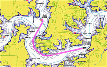
Auto guidance technology- Will search the attributes of all relevant charts to suggest the best course for navigation taking into consideration your desired safe depth and overhead clearance.


Please note, Garmin LakeVu Charts are not compatible with Garmin units pre-loaded with Garmin Navionics Mapping
Garmin LakeVu g3 Key Features
- Extensive coverage of 17,000+ lakes, rivers, and reservoirs across the U.S.
- More than 17,000 inland lakes available with 1 foot depth contours.
- High quality maps including points of interest such as docks, designated fishing areas, campgrounds, boat ramps, marinas and more.
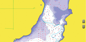
- Highly detailed underwater cartography.
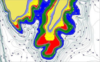
- Safety Shading to help protect against running aground.


